Death Valley! (Or a touch of the melodramatic)
I had been looking forward to this walk all week, I'd planned and gazed at the map, wondering what it was going to be like. I had chosen a 9 mile walk on the Quantocks but I knew it might be hot so I had a variety of points where I could peel off and head back, glad I did as it happens.
 I began in a car park above Weacombe on Staple Plain, it was so peaceful up there, and so brown and scorched. I'm surprised there haven't been any fires on the moors as its so dry. Well, the ground was, the air had a definite stickiness to it, making sure this walk was going to be a sweaty one.
I headed SW out the car park down hill towards Weacombe but became distracted by some cute dogs and missed my path! I eventually got my bearings and got back on track though and it was really pleasant walking through the woods. There had been a little rain the night before, not that you could see on the ground, but there were some beautiful spiderwebs in the gorse.
 There isn't much to Weacombe and I was soon out of it again, crossing a stream and back into the trees following the Coleridge Way.
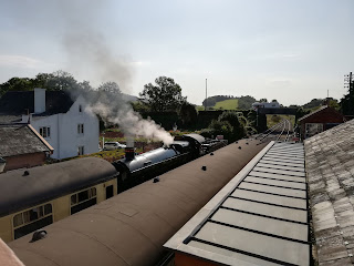
 This is a 50 mile trail starting in Nether Stowey, where the National Trust own Samuel Taylor Coleridge's house, and finishing at Lynmouth. On this walk the paths follow two long distance trails, the other one being the Macmillan Way West. This one is 102 miles from Castle Cary to Barnstaple. I have a bit of an issue with long distance routes, especially those that have been set up by non-local authorities or who don't have a specific ranger looking after them. The Long Distance Walkers Association (LDWA) lists 1500 trails in the UK. That's a lot of maintenance to do, and I expect that once the walks have been set up and published, all maintenance is then left to the local authority to do, because they have so much spare time and cash. I say this as an ex-rights of way officer. Anyway, there are some stunning views along this section and you can see the West Somerset Railway puffing past.


I headed SW out the car park down hill towards Weacombe but became distracted by some cute dogs and missed my path! I eventually got my bearings and got back on track though and it was really pleasant walking through the woods. There had been a little rain the night before, not that you could see on the ground, but there were some beautiful spiderwebs in the gorse.


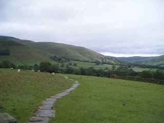
The next part of my route took me back up hill via Bicknoller Combe. The first third of the path is still under the trees so coolish, if a little sticky. However, as soon as you step out in to the sunshine you can feel the water being sucked from your body! The Combe acts as a heat trap, no air was passing though and I gradually got slower and slower, having to stop in the shade (when there was a wizened tree to shelter under) and keep drinking water. I'm glad I'd brought so much with me. I had never been so glad to see the top of a hill in my life and as soon as I left the Combe I could feel the breeze coming off the Bristol Channel, bliss. I must have looked a complete sight, red and sweaty. It was at this point that I decided that I couldn't do the rest of the walk, I simply couldn't carry enough water to get me through. However, Bicknoller Combe is very pretty and I did get a close encounter with a couple of deer.


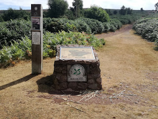
From here I walked along to Bicknoller Post, an old Boundary Post. There were quite a few people up the top and I chatted to a couple from Dorset who were on holiday. They had walked Death Valley the day before and had had the same trouble with the heat. I was glad to learn it wasn't just me being weak and feeble.
The rest of the walk was pleasant, even if I was dripping sweat from my ponytail. I followed The Great Road, an ancient droveway, back to the car park where I managed to find a little geocache before heading home.
Comments
Post a Comment