Posts

West Somerset Railway: Part 2

Image
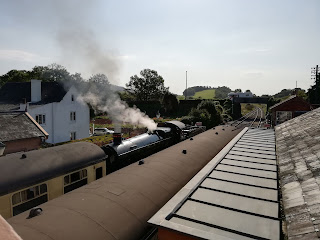
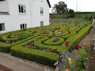
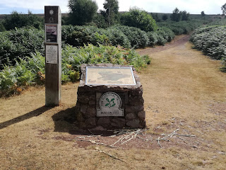
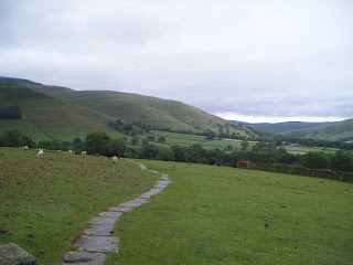
As I'm writing this the weather could not be more different than on the day of the walk. That day the air had a hint of autumn to it, the sun was shining and it was lovely and warm. Today, wet, cold and gloomy. Perfect I suppose for staying indoors and writing with a cuppa. The second half of this walk takes us from Williton to Bishop's Lydeard, finishing off the WSR route. I must say, the second half was more enjoyable and more challenging. The scenary was prettier but the paths were less travelled and there were more hills. Not a fan of them, mainly because I'm so unfit. However, I have a 'trudge' that will get me up them eventually without a coronary. We caught the train to Williton, we being my brother and his wife, and headed out for the last 12 miles or so of the walk. As you walk out of Williton, you pass a rather magnificent old building. It turns out that this was the old workhouse, which became a hospital. As is the way of things, the rural hospita

West Somerset Railway: Part 1

Image
For reasons unclear, I agreed to walk the West Somerset Railway. I blame my brother, he runs marathons and likes a challenge. So I said yes. It did mean a happy evening plotting the route onto an OS map from the West Somerset Railway website. Such fun. We put aside a weekend in August to do the walk, it's around 24 miles, so we were going to do it in two halves. The first part, Minehead to Williton, is just around the halfway mark. Getting there early was going to be a hassle as the trains and buses don't start running early enough. So we enlisted Mother, to keep it in the family, to drop us off.  On a bright and breezy August morning we were dropped off on the seafront at Minehead. To our left was the start of the South West Coast Path and right was the Somerset Coast Path. The beaches of Minehead are quite lovely, very sandy. Although the sand there now only dates from 1999. Most of it was washed away in a bad storm in 1990 and 320,000 tonnes of sand had to b

Death Valley! (Or a touch of the melodramatic)

Image
I had been looking forward to this walk all week, I'd planned and gazed at the map, wondering what it was going to be like. I had chosen a 9 mile walk on the Quantocks but I knew it might be hot so I had a variety of points where I could peel off and head back, glad I did as it happens. I began in a car park above Weacombe on Staple Plain, it was so peaceful up there, and so brown and scorched. I'm surprised there haven't been any fires on the moors as its so dry. Well, the ground was, the air had a definite stickiness to it, making sure this walk was going to be a sweaty one. I headed SW out the car park down hill towards Weacombe but became distracted by some cute dogs and missed my path! I eventually got my bearings and got back on track though and it was really pleasant walking through the woods. There had been a little rain the night before, not that you could see on the ground, but there were some beautiful spiderwebs in the gorse. There isn't much to Wea

Welcome to the Great Outdoors!

Image
I had forgotten how much I enjoy walking, especially on my own. I used to walk for a living as  Rights of Way Officer so I was out and about all the time, but since a career change and moving to another part of the country I haven't been out much at all. I joined a walking group to meet people but I just don't like walking in groups. You miss so much! The wildlife runs away, you can't stop to admire a view and you just can't listen to the world around you. Or perhaps I'm just a grumpy bitch. Plus, I can't geocache in a crowd (basically looking for Tupperware in the woods using million pound satellites). I had just finished reading Simon Armitage 's 'Walking Home' about walking the Pennine Way and it really made me realise how much I missed it. The descriptions of the weather, geography and maps flapping in the wind...  I wanted it!!!! I love maps, I'm a bit addicted to the Ordnance Survey. It reminded me of when I was in the Peak District l